Innovation
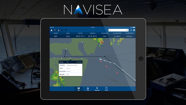
The Navisea app concept uses numerous data sets including AIS vessel tracking, navigation, port and dock data from the NDC, and much more. Navisea beautifully presents all of this data in a single user interface that's a mix between a dashboard and HUD.
Our simple route planning lets you get from one port to another quickly and easily. Along the way we'll show you any nearby traffic with collision alerts if necessary, areas of environmental sensitivity to avoid, weather, and even the paper charts you're used to. Once you near your destination, quickly access information about suggested routes into the port, what services are available at each dock, and contact information for the dock operator. With over a half-dozen datasets already integrated, we can't wait to expand Navisea's capabilities with additional features.
Impact
Navisea is an entry for the Shipping & Trade category, covering ship tracking, port information and more.
We believe that by combining all of this information into one simple application we can bring these tools to the wider general public, rather than relying on expensive systems used by large shipping companies or the paper / static charts used by smaller operators. The aviation industry has recently gone through a very similar and highly successful democratization with tools like the FltPlan tablet application, and we think it's time for the shipping industry to go through the same process. Our goal is, whether you're relocating a yacht or moving a bit of cargo, you'll find Navisea to be a useful companion on your trip.
While voyage planning and tracking is the main use-case for the application, we're continually adding new data to help support other objectives. An example is our display of marine protected areas on the map, in the hope that we can begin to encourage ships away from these areas during their transit and through appropriate sealanes. Allowing data expansion has been our primary focus from the start solely to support the philosophy of bettering ocean navigation from an efficiency and environmental viewpoint.