I prize a globally connected and accessible agricultural system, doing for global agriculture what Google Maps did for global businesses.
The Grand Challenge I propose is solving the fragmentation and disconnectedness of B2B and B2C within the agricultural industry. This disconnectedness leads to loss of business potential, innovation, and massive inefficiencies, which could deter us as a planet from being able to sustainably feed 9+ billion people by 2050.
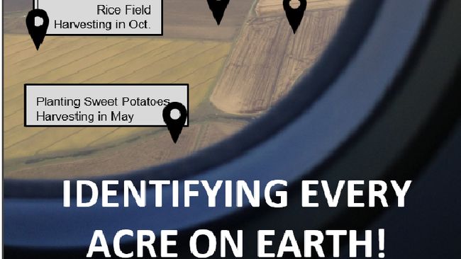
Background: As an entrepreneur, if I was developing a solution for the healthcare industry, I could use Google Maps and in minimal time, identify all the hospitals in a region. That alone grants me insight into market size, initial customers, market gaps, and paves the way for a potential innovation. In identifying and providing information on businesses globally, Google Maps/Business has allowed for this path for innovation. Looking at agriculture, there is no single platform right now you where someone could identify every acre of land on earth, let alone in a city or county. With the onset of 3-5 billion people coming online in the next 5 years, many of whom are in rural areas around the world, this platform for is increasingly necessary. This is a barrier to our human potential, and with 37% of the earth covered in land, the opportunity is huge.
In the simplest form, anyone would be able to look up any acre of land on earth and learn substantial information about it. On a larger scale, there would be a spike of interactive mobile and desktop applications engaging our physical world. Imagine an augmented reality game from your passenger seat that interacted with land around you as you drive, train, or even fly.
Even larger, there would be a major spike in service providers for agricultural producers, reducing prices for them and increasing service quality. More entrepreneurs would see this potential and join this space.