by NASA Tournament Lab
12
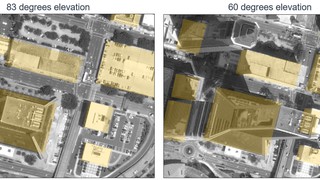
Overhead Geopose Challenge
Make satellite imagery taken from an angle more useful for time-sensitive applications like disaster and emergency response.